Conclusion
The advent of the airplane opened up new spaces of collaboration and contestation in modern East Asia, one that challenged the terrestrial boundaries of imperial and national states. Through the Manchuria Aviation Company, Japan sought alliances with Germany and Italy, as well as rivalries with the United States and the Soviet Union, at the expense of Chinese and Mongol sovereignty on the ground.
gender/children, tourism, cultural pluralism and constructions of place, capitalist modernity
new visions of capitalist modernity, also new way of looking at the world.
In bringing the land increasingly under an ocular occupation, the aerial perspective produced compelling spatial and temporal representations of Inner Asia. It emphasized a precise, revelatory, and immediate kind of knowledge. The halting advance of the Manchuria Aviation Company certainly demonstrated the possible extent of reconnaissance from the sky. The thousands of aerial photographs by the Manchuria Aviation Company in the 1930s and 40s might initially point to a panoptic fixation of imperial Japan. Mapping and measuring the terrain, plotting points to coordinates on a putatively universal grid, these pursuits meant another level of scientific entrenchment where the land could not escape the purview of trigonometric calculation.
Even after these photographs themselves sit in archives as forgotten ‘moments’ and collect dust, their tangible legacies remain. Monuments to colonial development built upon felled forests and barren earth stand as an enduring, though ambivalent testament to the technological imaginary, the realm of possibility for empire opened up by the view from above. By war's end, as the modules by David Fedman and Michitake Aso demonstrate, the view from above took on new significance throughout Asia, from incendiary bombs in China and Japan to biological warfare in Korea and Vietnam. It was a different, far more destructive meaning.
The advent of aviation in the early twentieth century opened up an uncertain and contingent space of the Japanese empire, in between borders that did not so neatly align between land, sea, and air. This new form of transportation superseded earlier networks of ships and rail, extending the Japanese empire westward, from Manchukuo to Inner Mongolia, and beyond.
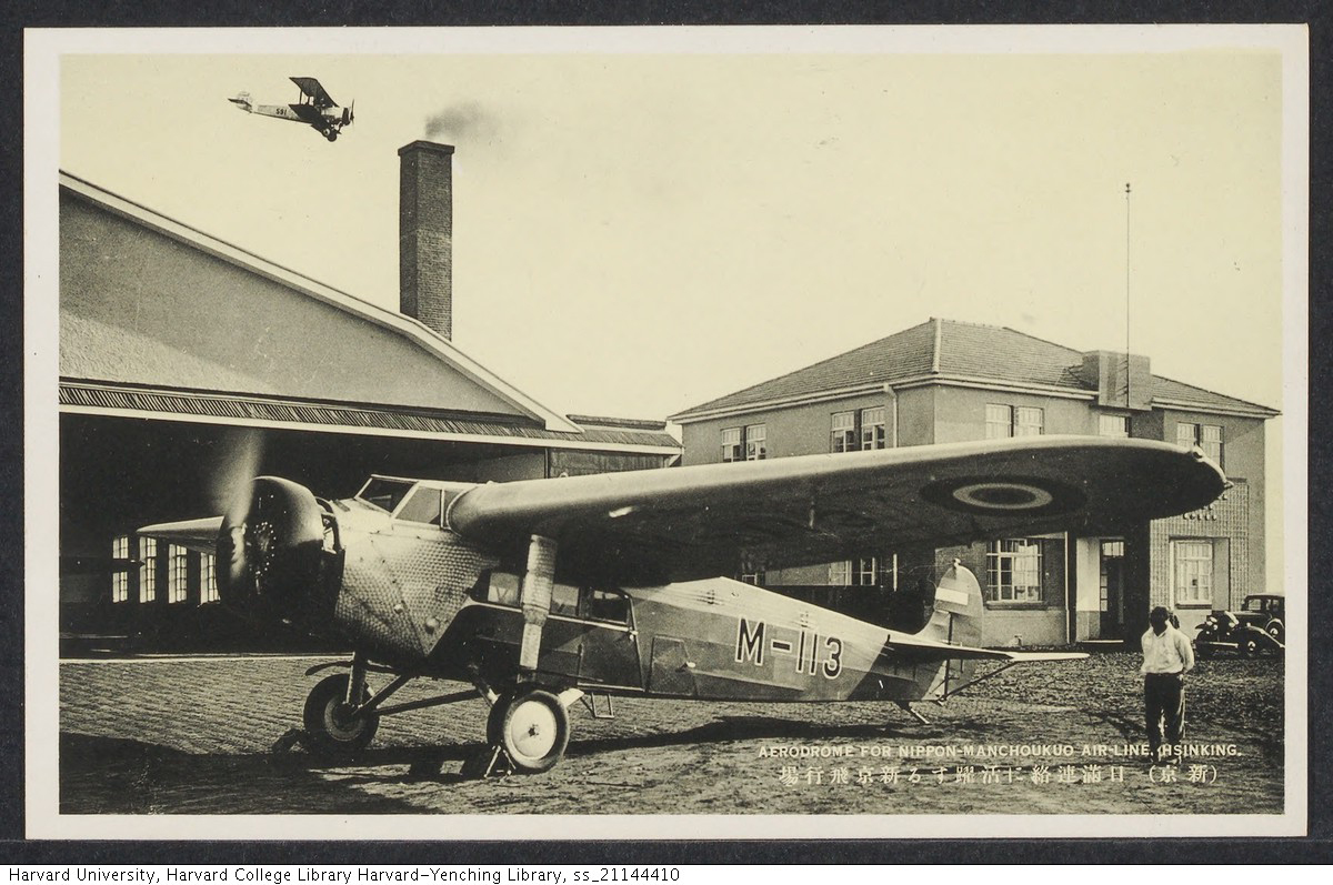
This module examines how the aerial perspective, as made possible by aviation, helped Japanese occupiers imagine the Eurasian continent in its geographical vastness, and yet how their terrestrial limitations ultimately failed to sustain control over this space. For imperial Japan, the Manchuria Aviation Company (J. Manshūkoku kōkū kabushiki kaisha), founded in 1932, would become the predominant presence over Inner Asia during the wartime era.
The first pathway, Reading ManAir Magazine, delves into the modern spaces created by the Manchuria Aviation Company through its in-house magazine, ManAir (J. Mankō). The Manchuria Aviation Company advertised its services by portraying its technological prowess and geographical reach. The corporation also sold the concept of flight with images of the modern woman and, as the Pacific War intensified, militarized children. ManAir intentionally conflated patriotic duty and its profit motive, using nationalism as a vehicle to drive its commercial viability.
The second pathway, Eurasian Expansion, explores how Japanese air control outpaced its land occupation, as the Manchuria Aviation Company flew farther into the Republic of China and made alliances with Mongol princes. The territory surveyed by the Manchuria Aviation Company was sprawling, their mode of vision, exclusive: besides Japanese endorsements and Chinese critiques, indigenous reactions to these aerial incursions, for the most part, did not exist.
Finally, the third pathway, Technologies of the Gaze, focuses on the seemingly objective renderings of the land produced by aerial photographs, developed in the ‘dark room’ of Japanese imperialism. This form of visual technology both fueled and followed geographical understandings of the Asian continent in the 1930s and 40s.
The view from above held a
revelatory power of instantaneous
knowledge, leading those
involved in the enterprise to
believe that they had achieved a
most powerful convergence
between sight and knowledge
for the empire to date.
.jpg)
_thumb.jpg)
.jpg)