Learning in the Sinosphere
The Korean War (1950-1953) and the First Indochina War (1946-1954) were closely linked. A key event in Asia underlying both wars was the 1949 victory of the communist party, led by Mao Zedong, over the nationalist party and the formation of the People's Republic of China. With the founding of the PRC, and the subsequent entry of Chinese troops into the Korean War (1950-1953), understandings of the First Indochina War began to shift. Among United States leaders, the events of 1949 and 1950 recast the fighting on the Indochina peninsula from a colonial war in which the United States opposed the French, to a part of the Cold War in which the two shared common interests. Even though French leaders remained intent on keeping at least some of Indochina (Cambodia, Laos, and Vietnam) as part of their empire, they were content to receive American aid that was earmarked as part of the battle against communism.
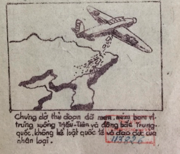
Ho Chi Minh and the Việt Minh were likewise careful observers of the Korean War. They quickly understood the implications when the North Koreans and Chinese communists leveled charges of biological warfare against the United Nations forces, led by the United States. Vietnamese intellectuals and political leaders were inspired to draw on existing Sinosphere maps. Vietnamese leaders turned to political, intellectual, and cultural connections to China and Korea for relevant experience with biological warfare. Newer maps of the communist world both reinforced Sinosphere maps and placed Vietnam at the center of newer political geographies of revolution.
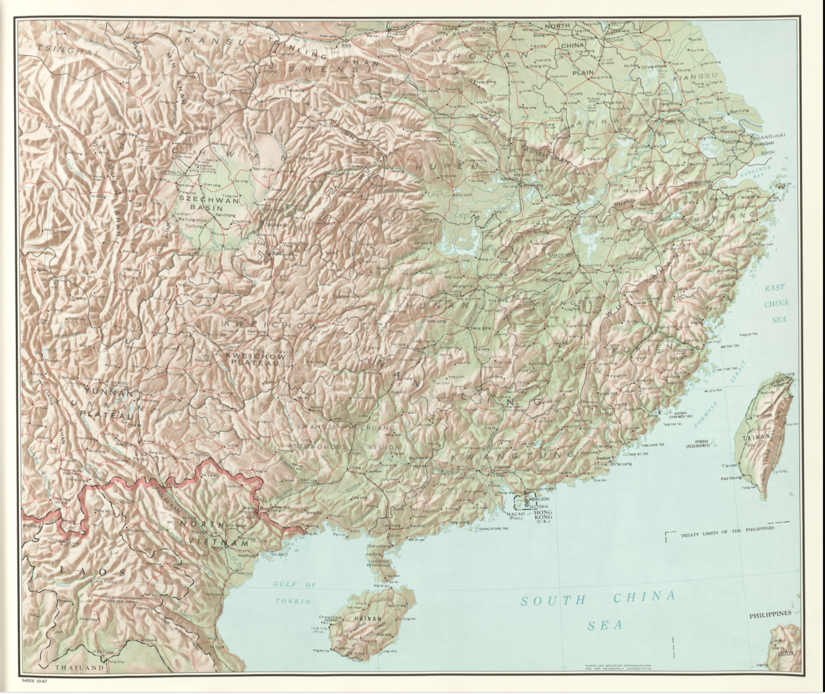
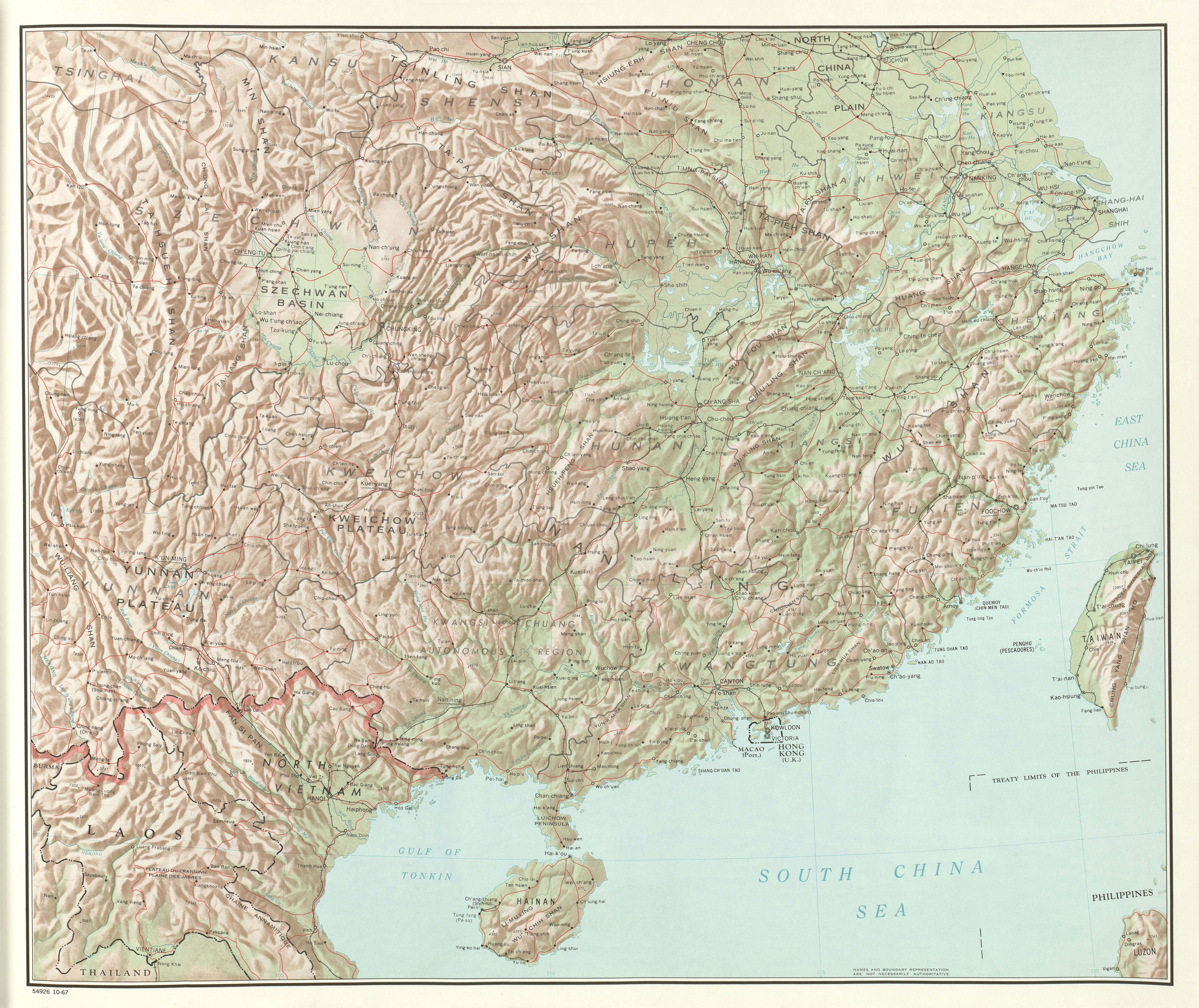
Consider the following map published by the US Central Intelligence Agency in 1967. While this map presents a topographic view of Northern Vietnam, thus using the language of scientific objectivity, there were at least two important choices to note. First, it reproduces older Sinosphere and regional geographies by linking Northern Vietnam to its northern neighbor. This decision was not accidental, of course, and like earlier regional maps had a military motivation. Starting in 1965, the United States had sent its military to the Republic of Vietnam and began what is known in America as the Vietnam War. During this war, communist China sent aid and advisors to North Vietnam. Second, this map notes the major population centers of Hanoi and Thai Nguyen and shows them linked by a railroad. Both Hanoi, as the capital, and Thai Nguyen, as a major industrial city, were targets of incessant American bombing. The railroad linking the two cities was also a prime target [verify].
In this way, the shape of this map was the result of the victories of first the Chinese, and later the Vietnamese, communist parties.