"Geological Map of Sui-yuan"
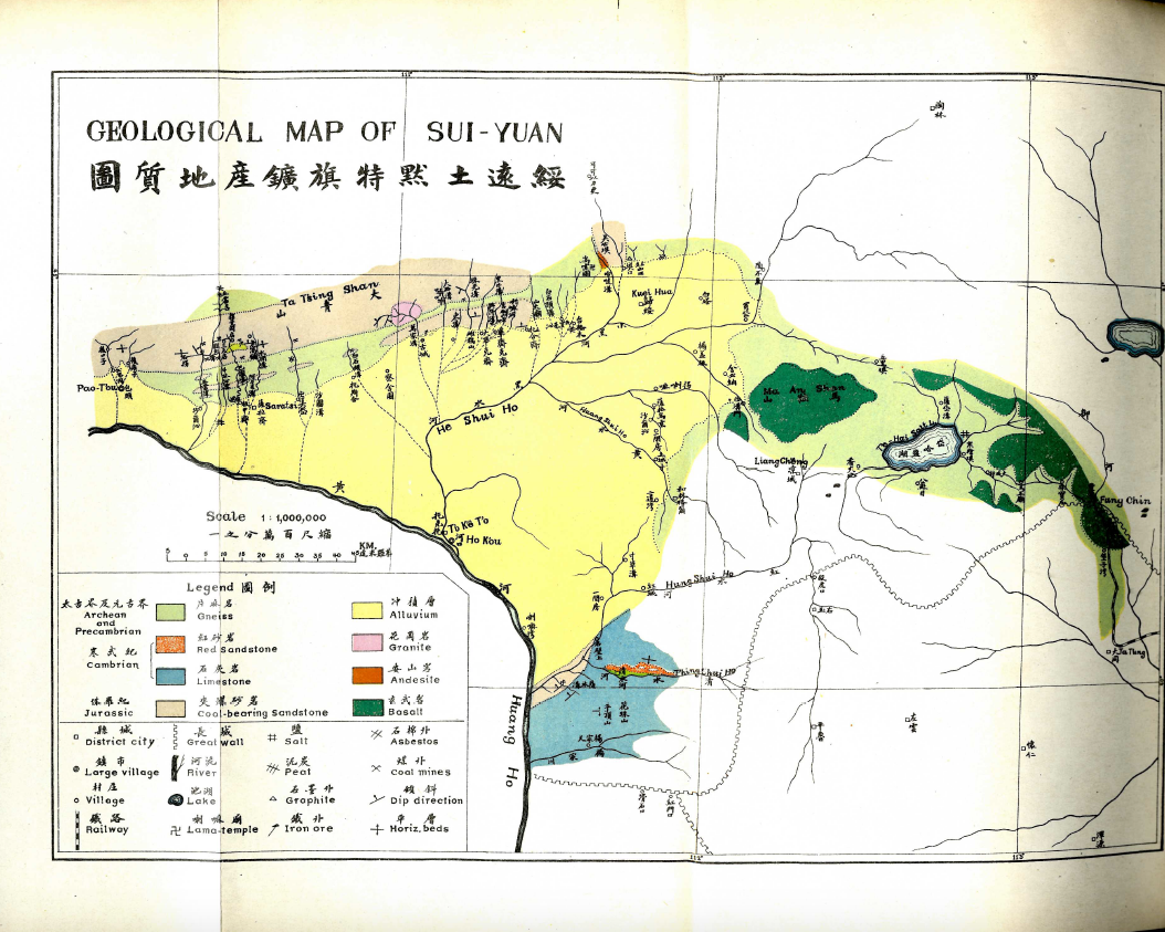
1 2020-04-30T18:06:25-04:00 Kate McDonald 306bb1134bc892ab2ada669bed7aecb100ef7d5f 35 2 Weng Wenhao and Cao Shusheng, Dizhi huibao 地質彙報 (Bulletin of the Geological Survey of China), No. 1 (1919), after p35. plain 2020-09-16T00:16:28-04:00 Public domain. Shellen X. Wu SXW-0023 Kandra Polatis 4decfc04157f6073c75cc53dcab9d25e87c02133This page is referenced by:
-
1
2020-04-30T18:06:13-04:00
Surveying Empire
8
Geological Surveys and the Vertical Frontier
plain
2021-04-20T14:14:44-04:00
46.46918, 121.24832
Xing'an
40.8106, 111.6522
Suiyuan
1919-1929
Shellen X. Wu
South Manchuria Railroad
Geological surveys bolstered Han Chinese claims to resources in frontier areas from the late Qing through the Republican period and the founding of the People’s Republic in 1949. Both Japanese and Chinese geologists raced to survey contested territories. Geology quickly became the first science formally endorsed by the new Republic. The Geological Survey of China was the new Chinese republic's first scientific institution and began publishing a journal on geological research in 1919.
To fuel plans to develop Xing An, survey teams paid careful attention to potential coal and other valuable minerals in the region. In a grandiose report full of ambitious but vaguely defined plans for the construction of transportation networks, schools, and the creation of a civil administration, the discussion on the development of logging and mining delved into specific details, including information on the locations of coal seams and valuable mineral deposits. Earlier in the late nineteenth and early twentieth centuries, Russian geologists and mining engineers had surveyed the region for gold; the Chinese officers brought their own experts. Subsequently, the Japanese-controlled South Manchuria Railroad also showed an interest in developing mining enterprises in the region.