The Tang Rivers on the Plain
An extensive water system exists between the Ou and Feiyun rivers. This system, which is spread across the urban area of Wenzhou and nearby Rui'an County, is called the Wenruitang River. It is widely known as “the mother river of the Wenzhou people,” as it connects most of the prosperous regions through the density of its canal channels.
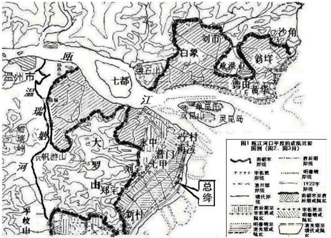
The canals in this water system are called “tang.” This term originally meant seawalls (hai-tang); it also now refers to canals (tang-he), as many such canals were formerly seawalls. From the map provided by Songdi Wu, a historical geographer of the southeast Chinese coast, one can see how these seawalls turned into canals.
As Songdi Wu points out, most of the lands in today's Wenzhou were under the sea in 3000 BCE. The three major rivers brought sand to the shores and created outfall plains. Local communities then settled on the new lands and built seawalls to protect against strong tides and floods.
The map on the top demonstrates the changing shorelines around the lower Ou River region. During the Liu Song dynasty (420-479), the sea’s shore (the bold line) was quite distant from the current shoreline. The dark area, which is now part of the Wenzhou Plain, was still under the sea. This Liu Song shoreline was close to the old seawall, where people built parallel walls and turned the ditches into canals. The canals were used for multiple purposes, including irrigation, flood drainage, and transportation.
While plains continued to expand due to sand accumulation, the new lands, again, became the sites and instruments of conflicts. Villages drew boundaries on the land, while peasants and fishermen competed for resources for cultivation and fishery. The old seawalls, together with the new canals, thus became an integral part of the dynamic formation of the Wenzhou Plain.
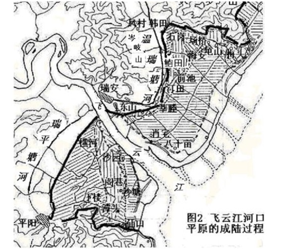
The second map shows shorelines similar to those found on the first map. The previous seashore was quite distant from the current one, while a major branch of the Wenruitang River was close to the previous shore. The bold line went through many villages of Rui'an, including Dongshan, Xincheng, and Baotian. The dark region above the Feiyun River is now part of the Wenzhou-Rui'an Plain, while the one below — and along another major tang river—is now part of the Rui'an-Pingyang Plain.
All these canals are not only “water.” They are an important part of Wenzhou's "land"—a part that has significantly shaped the life in this water town.
This page has paths:
This page has tags:
Contents of this tag:
This page references:
- Map of the Epeirogenic Process of Wenzhou's Coastal Plain—Around the Mouth of Ou River (by Wu Songdi)
- Map of the Epeirogenic Process of Wenzhou's Coastal Plain—Around the Mouth of Feiyun River (by Wu Songdi)
- "Wenzhou—A true Venice of South China, the city is crisscrossed by multiple canals" (by Cyprien Aroud)